Home / Animated map "Emission of polluted substances in atmospheric air"
 
Animated map "Emission of polluted substances in atmospheric air"
17.10.2014
Animated map "Emission of polluted substances in atmospheric air"

Animated data visualisation using this application presents the changes in territorial aspect of indicators related to emission of polluted substances in atmospheric air, including solid, gaseous and liquid substances  from 2007 to the present.

The application was developed in collaboration with Data Visualisation Centre of United Kingdom’s Office for National Statistics.

Technical specifications:

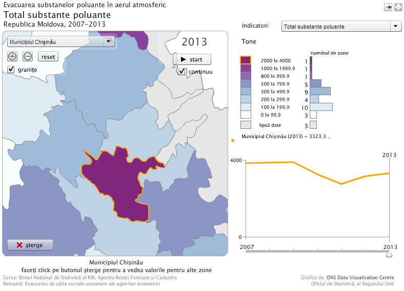
To see the map, click on the picture. Various options will be described under the map on mouseover. You must have the browser plugin Flash installed in order to view the application.

Useful links:

Home / Animated map "Emission of polluted substances in atmospheric air"
Tel. 022 40 30 00
Fax
106 Grenoble Str., MD-2019 Chisinau, Republic of Moldova
Email: moldstat@old.statistica.md
Copyright © 2024 NATIONAL BUREAU OF STATISTICS OF THE REPUBLIC OF MOLDOVA
Terms of use
Print